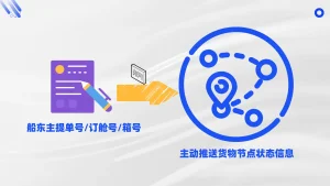
Integrate targeted tracking pipelines optimized specifically for key routes connected to the Port of Ana Chaves, the Port of Neves, and São Tomé International Airport.
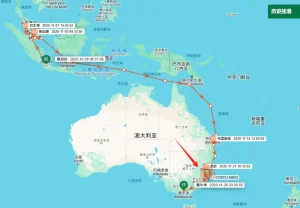
As an archipelagic nation located in the strategic waters of the Gulf of Guinea, São Tomé and Príncipe relies almost exclusively on maritime shipping lanes for import, export, and regional transit operations. Primary agricultural outputs such as organic cocoa, high-grade coffee, and palm oil require optimized, time-sensitive delivery mechanisms to reach international markets in Europe, America, and continental Africa.
However, maritime logisticians operating within São Tomé face distinct challenges: limited deepwater berthing, vulnerability to ocean swell variations, and maritime route congestion in West African corridors. By integrating advanced Shipment Tracking Services powered by multi-source AIS data telemetry, regional operators can preempt cargo delivery delays, automate customs processing notifications, and drastically reduce demurrage fees at the Port of Ana Chaves and the Port of Neves.

Founded in 2015, Trackingeyes is a leading provider of global end-to-end logistics tracking and supply chain visualization solutions. With a founding team boasting over ten years of logistics expertise, we deeply understand industry pain points. We specialize in global end-to-end cargo tracking by sea and air, serving thousands of import and export enterprises worldwide. Our services include customizable tracking solutions and open API data interfaces to enhance supply chain visibility and operational efficiency.


Unlock end-to-end visibility with our trusted tracking platform. We bring proven reliability to both ocean and air cargo tracking, giving you the accurate data and control needed to streamline operations from port to runway.
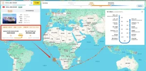
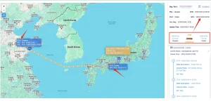
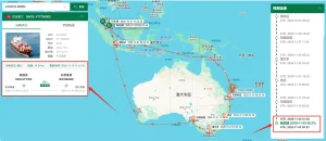
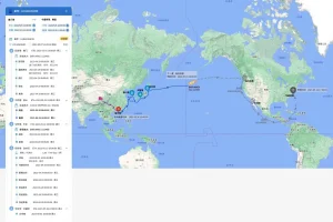
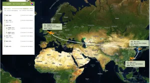
By compiling telemetry from both terrestrial and satellite AIS receivers, we eliminate ocean dead-zones. Maintain real-time positional contact with cargo vessels navigating the South Atlantic transit corridors.
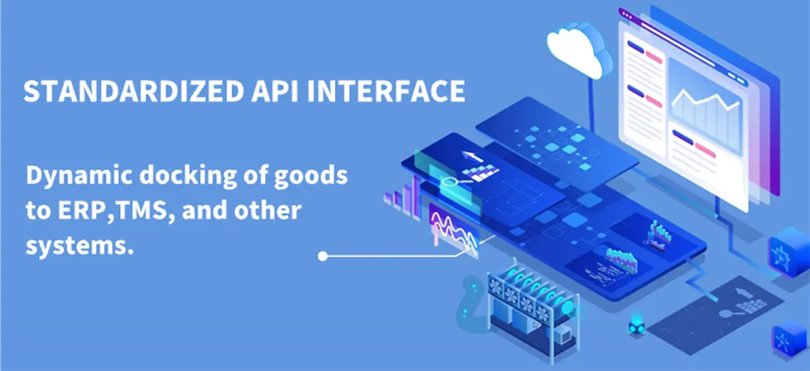
Seamlessly integrate real-time tracking JSON payloads into existing ERP systems (SAP, Oracle, Microsoft Dynamics) to automate notification workflows, updates, and custom status alerts.
Leverage historic terminal patterns, real-time meteorological metrics, and congestion indicators to generate hyper-accurate arrival estimations that outclass standard carrier reports.
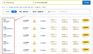
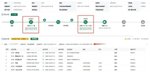
The platform achieves full chain data coverage from the source to the terminal through the collection and aggregation of data sources, including logistics information from various data sources such as stations, terminal, customs, shipping companies, and airlines.
Through the Trackingeyes’ Platform, customers can quickly connect with hundreds of global data sources, greatly improving the efficiency and intelligence of logistics tracking. Through API interface integration, the dynamics of goods can be automatically written back to internal systems and customer service systems of the enterprise, assisting global logistics enterprises, supply chain enterprises, cross-border e-commerce enterprises, software platforms and other enterprises to achieve more efficient and refined goods tracking management, and to do risk control and prediction in advance.
We are shaping the future of global maritime technology by expanding terrestrial satellite receiver networks across critical oceanic junctions.
Select from our specialized suite of global ocean, air, and dry terminal data synchronization products.
For logistics managers in São Tomé and Príncipe, operational success relies on linking localized transport services with global shipping lines. When cargo transships through regional hubs like Libreville, Luanda, or Lagos, visibility gaps often emerge. Standard container tracking services frequently lose signal between major terminals and final delivery destinations in São Tomé.
Trackingeyes solves this by aggregating deep maritime datasets into a single dashboard. Whether managing bulk agricultural exports (cocoa, coffee) or critical machinery imports for infrastructure projects, shippers can track cargo status directly, avoiding delayed handovers and expensive terminal storage charges.
Key insights regarding our global shipment tracking capabilities in São Tomé and Príncipe.
Connect with our engineering team to request a customized API demo, integrate our tracking solutions into your ERP, or receive pricing estimates for global vessel telemetry.
Send Inquiry Now