1 / 1
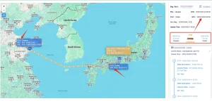
As global trade continues to accelerate, maritime transport is no longer solely focused on "arrival" but increasingly demands "transparency," "traceability," and "control." When cargo is navigating vast ocean distances, wouldn't you want to know the vessel's current location, its next destination, and its estimated time of arrival, just like checking real-time navigation?
The vessel Automatic Identification System (AIS) is the core technology enabling this, providing reliable, real-time, and visual dynamic data support for modern shipping.
 The AIS system utilizes BeiDou or GPS satellites to provide precise positioning for vessels, continuously generating latitude and longitude coordinates. Much like a map providing location data for a mobile phone, these satellites determine a "global coordinate" for the vessel. This positional information, along with critical data such as vessel name, speed, course, and type, is automatically broadcast and shared in real-time via VHF maritime bands. Whether in open seas, coastal areas, or dense traffic lanes, surrounding vessels and shore-based receiving stations can quickly access this information, ensuring navigation is no longer conducted with "blind spots."

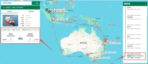
In waters with limited signals or complex environments, the AIS shore-based network further applies multi-station triangulation technology. By cross-verifying signal time differences from multiple receiving points, it enhances the stability and reliability of vessel positioning. This means that even under challenging sea conditions, adverse weather, or suboptimal satellite signal reception, vessel position information can still be accurately presented.
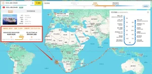
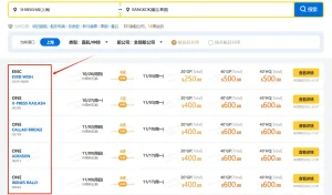
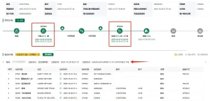
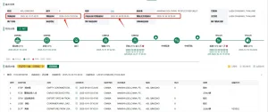
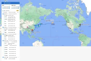
Through the real-time collection and aggregation of massive data streams, AIS constructs a comprehensive global network of vessel movements. Regulatory authorities, port operators, shipping companies, and cargo owners can all monitor vessel courses, dynamic changes, and estimated times of arrival (ETAs). This facilitates a shift from being "unseen" to "clearly visible," and from "passive waiting" to "instantaneous awareness."
The establishment of this system not only significantly enhances navigational safety and reduces collision risks but also provides quantifiable, analyzable data support for port scheduling, cargo tracking, route planning, and risk. This leads to a comprehensive improvement in maritime operational efficiency.

With the continuous expansion of global trade volumes, shipping digitalization has become an irreversible trend, and vessel AIS stands as one of the most critical foundational infrastructures enabling this transformation. It ensures vessels remain connected at sea, makes logistics status transparent and visible, enables more precise and efficient government oversight, and provides clients with a "traceable" and "verifiable" transport process they can consistently trust.
Vessel AIS is more than just positioning. It is making global shipping safer, more efficient, and smarter. 
Trackingeyes not only provides data interfaces for vessel AIS but also offers a seamlessly embedded demo page on our official website. Maritime industry professionals are welcome to visit, explore its capabilities, and join us in stepping into the new era of visual maritime transport.
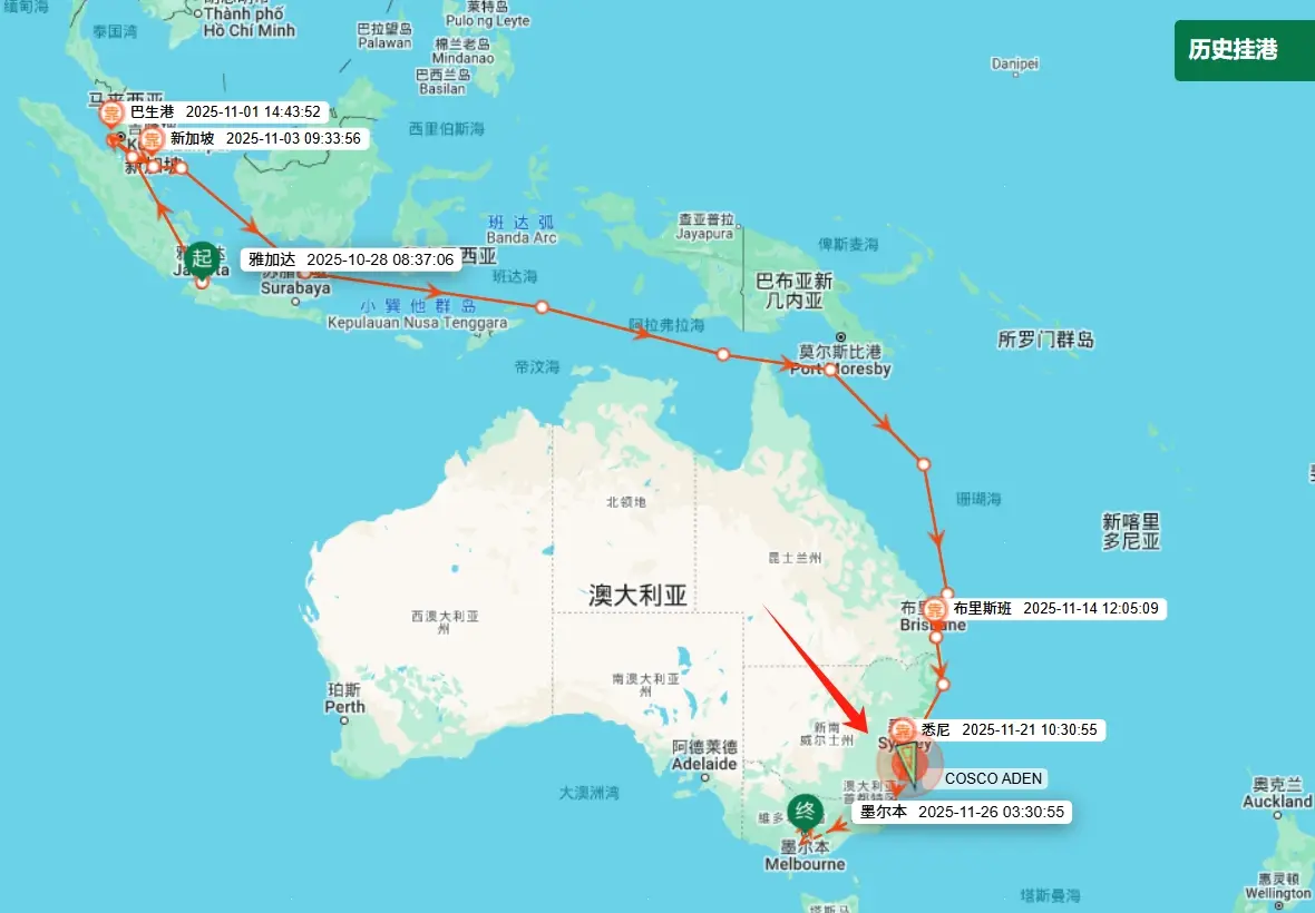
description1
description2