Explore our top-tier tracking instruments optimized to handle Elbe navigation variables, local terminal clearance workflows, and intermodal connectivity.
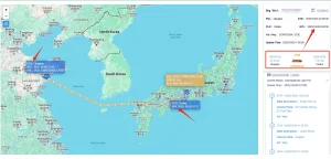
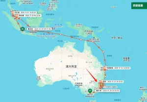
The Port of Hamburg, celebrated as Germany’s "Tor zur Welt" (Gateway to the World), functions as the third-largest container port in Europe and the single largest rail port on the continent. Handling over 8 million TEUs annually across its major container terminals—Burchardkai (CTB), Altenwerder (CTA), Tollerort (CTT), and Eurogate—the port serves as the principal inland ocean conduit linking the East Asian manufacturing hubs directly with the massive European consumer markets.
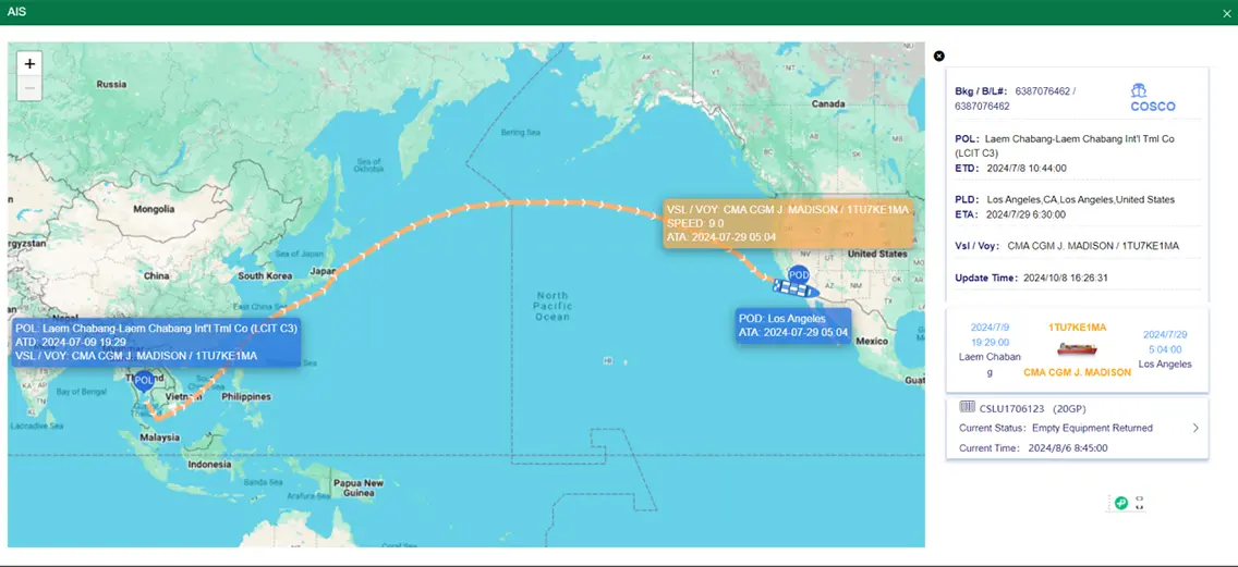
However, Hamburg’s unique geographical layout presents specialized operational friction. Located approximately 110 kilometers inland via the Elbe River estuary, vessels are highly susceptible to tidal constraints, draft limitations, and lock congestion. Any deviation in ocean transit times immediately impacts the terminal scheduling slot system. Shippers who operate without high-frequency, real-time AIS vessel telemetry and automated ETA calculation frequently encounter severe downstream delays. Once container carriers face delays on the Elbe, the hinterland railway connections (such as Metrans and the Hamburg Port Railway network) experience immediate bottlenecking, resulting in substantial demurrage costs and missed assembly schedules.
Trackingeyes resolves this volatility. By processing dynamic terminal metrics directly alongside real-time AIS feeds, we translate physical port congestion into structured, predictive data streams, enabling global manufacturers to adjust container dispatch configurations before bottlenecks materialize.

In the contemporary global trade ecosystem, logistics complexity has escalated. Legacy supply chains traditionally relied on ocean carrier EDI (Electronic Data Interchange) messages (such as EDI 315 status signals). This architecture exhibits latency ranging from 12 to 36 hours and lacks verification. If a vessel anchors off the coast of Western Europe due to regional port strikes or weather patterns, a carrier EDI status report might show the container status as "In Transit" until hours after a missed connection.
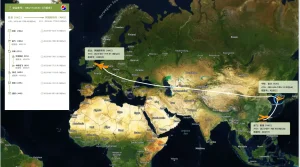
The transition toward AIS (Automatic Identification System) tracking technology represents a paradigm shift. True global visibility requires a sensor-driven, carrier-independent data collection layer. By fusing terrestrial AIS receiver data with high-frequency low-Earth-orbit (LEO) satellite feeds, Trackingeyes gathers real-time spatial positioning of ocean liners. This telemetry is continuously parsed through machine learning models to assess routing patterns against historical port turnaround indicators. The result is "Information Gain"—the delta between static carrier projections and real, verifiable ocean container progress.
Simultaneously ingest schedules and track containers from 99% of global shipping lines under a single data pipeline.
Eliminate blind spots on long ocean crossings using constellation satellite signal capture technology.
Consistently recalculates estimated time of arrival based on weather patterns, port backlogs, and seasonal factors.

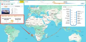
China remains the powerhouse of industrial manufacturing, providing highly integrated production ecosystems that range from raw materials to precision machinery. Industrial hubs like Shenzhen, Ningbo, Qingdao, and Shanghai deliver unmatched manufacturing speed. However, this production efficiency is often degraded once the goods leave the factory loading dock. Port delays, transshipment lags, and poor ocean visibility can dilute China's manufacturing speed advantages before the cargo arrives in Europe.
Integrating Trackingeyes technology directly into Chinese factory logistics pipelines addresses this gap. By linking Chinese domestic logistics with global ocean AIS telemetry, manufacturers and European importers establish a continuous, real-time data link. Importers at European hubs like Hamburg can track components from the moment they are loaded onto the vessel in Shanghai or Shenzhen. This continuous visibility allows European manufacturing plants to adjust production schedules dynamically, maintaining low buffer inventories without risking production downtime.
Driving logistics efficiency with reliable, data-driven ocean and air cargo visibility solutions.
Founded in 2015, Trackingeyes is a leading provider of global end-to-end logistics tracking and supply chain visualization solutions. With a founding team boasting over ten years of logistics expertise, we deeply understand industry pain points. We specialize in global end-to-end cargo tracking by sea and air, serving thousands of import and export enterprises worldwide. Our services include customizable tracking solutions and open API data interfaces to enhance supply chain visibility and operational efficiency.
The platform achieves full chain data coverage from the source to the terminal through the collection and aggregation of data sources, including logistics information from various data sources such as stations, terminal, customs, shipping companies, and airlines. Through the Trackingeyes’ Platform, customers can quickly connect with hundreds of global data sources, greatly improving the efficiency and intelligence of logistics tracking.
Unlock end-to-end visibility with our trusted tracking platform. We bring proven reliability to both ocean and air cargo tracking, giving you the accurate data and control needed to streamline operations from port to runway.
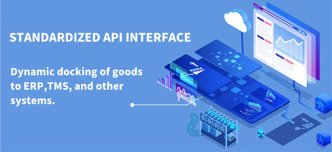
Through API interface integration, the dynamics of goods can be automatically written back to internal systems and customer service systems of the enterprise, assisting global logistics enterprises, supply chain enterprises, cross-border e-commerce enterprises, software platforms and other enterprises to achieve more efficient and refined goods tracking management, and to do risk control and prediction in advance.
As global maritime operations face increasing volatility, key technological shifts are shaping the next generation of supply chain execution.
Modern transit optimization moves beyond relying strictly on linear speed and destination distance calculations. Modern tracking models analyze years of terminal turnaround records, seasonal weather tendencies, historical canal backlogs, and real-time congestion indices. If a vessel shows a standard heading but the destination terminal in Hamburg is facing an backlog of feeder vessels, the system automatically recalculates the actual container pick-up window, bypassing carrier-published ETAs.
The global shipping industry is shifting away from archaic EDI communication infrastructures in favor of standardized REST APIs. Supported by the Digital Container Shipping Association (DCSA), this normalization enables freight forwarders, terminal operators, and cargo owners to exchange shipment milestones instantly, minimizing developer onboarding times and data discrepancies.
Global regulatory frameworks increasingly require enterprises to audit and report their secondary logistics carbon footprints. Real-time tracking engines now utilize AIS distance logs, vessel engines, and cargo weight datasets to calculate precise per-container carbon emissions, helping companies hit their ESG targets.
For large-scale international manufacturers, logistics visibility is highly valuable when integrated directly into core execution environments like SAP, Oracle, or customized in-house Transport Management Systems (TMS). Pulling web interfaces manually is inefficient at scale; instead, data must flow directly into procurement and order management systems.
The Trackingeyes API provides clean JSON payloads that deliver real-time container coordinates, predicted terminal congestion levels, historical carrier speed profiles, and predictive exception flags. This allows automated workflows to manage inventory allocations, dispatch warehouse personnel, and organize rail links automatically, bypassing manual coordination.
{
  "tracking_number": "TEX9876543210",
  "vessel_name": "HAMBURG EXPRESS",
  "imo_number": 9461013,
  "carrier": "Hapag-Lloyd",
  "departure_port": "Shanghai (CNSHA)",
  "destination_port": "Hamburg (DEHAM)",
  "route_status": "Elbe Estuary Transit",
  "scheduled_eta": "2025-10-15T08:00:00Z",
  "predictive_eta": "2025-10-15T10:30:00Z",
  "last_ais_update": "2025-10-15T05:12:10Z",
  "delays_detected": false,
  "congestion_risk": "Low"
}
Get answers to critical technical and operational questions about maritime logistics and automated tracking APIs.
Our engine combines real-time AIS signals with historical terminal performance databases and Elbe tidal schedules. This allows us to calculate potential lock delays and vessel speed limitations, providing accurate ETA updates instead of relying solely on carrier estimates.
We offer comprehensive REST APIs and documentation that fit cleanly into systems like SAP, Oracle, and customized TMS architectures. Integration typically takes just a few days, supported by our technical development teams.
We combine terrestrial and satellite AIS networks to keep latency low. In areas with minimal signal coverage, our machine learning models calculate estimated paths based on historical routing data, updating automatically when the vessel re-establishes contact.
Yes. Our end-to-end visibility solutions track containers across rail and road links, helping you monitor freight journeys from terminal arrivals through to final delivery locations in Central and Eastern Europe.
By providing real-time alerts on terminal availability, gate opening changes, and custom clearance updates, our platform helps logistics teams schedule pick-ups and returns dynamically, avoiding expensive storage fees.
Yes, our visibility platform covers both ocean and air cargo tracking, offering unified status tracking for multimodal shipments through global airports, including Hamburg Airport (HAM).
Complete visibility solutions, including API integrations, ERP connectors, and port notification systems, engineered to keep your logistics operations running smoothly.