Maximize supply chain resilience in the Middle East with our real-time visibility engines tailored for Umm Qasr and Baghdad customs corridors.


Founded in 2015, Trackingeyes is a leading provider of global end-to-end logistics tracking and supply chain visualization solutions. With a founding team boasting over ten years of logistics expertise, we deeply understand industry pain points. We specialize in global end-to-end cargo tracking by sea and air, serving thousands of import and export enterprises worldwide. Our services include customizable tracking solutions and open API data interfaces to enhance supply chain visibility and operational efficiency.
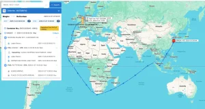
Through the Trackingeyes’ Platform, customers can quickly connect with hundreds of global data sources, greatly improving the efficiency and intelligence of logistics tracking. The platform achieves full chain data coverage from the source to the terminal through the collection and aggregation of data sources, including logistics information from various data sources such as stations, terminal, customs, shipping companies, and airlines.


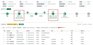
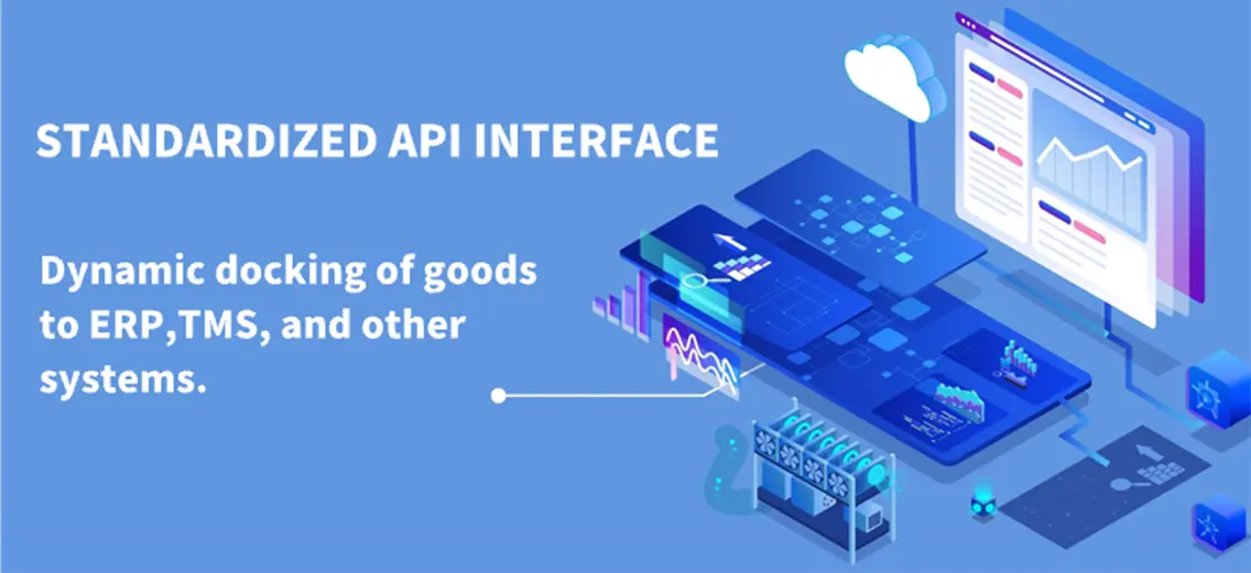
Through API interface integration, the dynamics of goods can be automatically written back to internal systems and customer service systems of the enterprise, assisting global logistics enterprises, supply chain enterprises, cross-border e-commerce enterprises, software platforms and other enterprises to achieve more efficient and refined goods tracking management, and to do risk control and prediction in advance. Unlock end-to-end visibility with our trusted tracking platform. We bring proven reliability to both ocean and air cargo tracking, giving you the accurate data and control needed to streamline operations from port to runway.
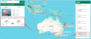
Iraq is positioned at a key logistical crossroads connecting the Persian Gulf with Turkey, Jordan, and the broader Middle East. However, supply chain operators in the region face distinct administrative, geographical, and infrastructural hurdles. Standard GPS-based tracking systems frequently experience service drops near borders, and port congestion at southern gateways like Umm Qasr Port can lead to significant customs delays. For regional manufacturers, oil-and-gas enterprises, and engineering contractors, real-time shipment visibility is essential for operational continuity.
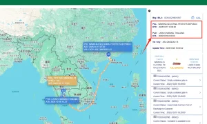
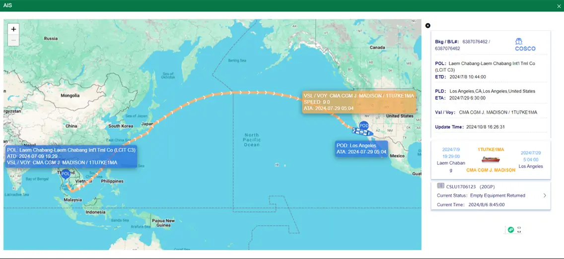
Umm Qasr Port (North & South Terminals) handles over 80% of Iraq's non-oil maritime imports. The primary operational bottleneck here is administrative processing. Container dwell times can extend to 10–15 days due to complex paper-based customs checks, BV (Bureau Veritas) inspections, and compliance review cycles. Traditional tracking software that relies solely on carrier EDI messages fails when cargo is delayed inside port areas. By integrating Terrestrial & Satellite AIS Data with port terminal operating systems (TOS) via API, Trackingeyes provides precise tracking during these critical transitional phases.
Furthermore, cross-border overland corridors—such as the northern route from Turkey via the Ibrahim Khalil border crossing, or the western route from Jordan—require continuous monitoring. Standard supply chain platforms often lose signal coverage along these dry-port highways. Our solutions combine localized cellular network failovers, satellite IoT data, and predictive route modeling to maintain continuous oversight, helping to protect cargo and improve scheduling reliability across Middle Eastern corridors.
China's logistics ecosystem leads in combining robust hardware manufacturing (GPS, BLE beacons, active RFID trackers) with scalable SaaS platforms, providing a unified hardware-software tracking solution.
Designed to scale for high-volume transactions, our RESTful API interfaces process massive data queries without service disruption, facilitating seamless integration with ERP systems.
We reduce tracking costs per container through optimized manufacturing pipelines and strategic commercial carrier partnerships, helping to lower overhead expenses for import-export firms.
In addition, Chinese logistics platforms offer strong alignment with Belt and Road Initiative (BRI) trade lanes. Because a significant share of Iraq’s reconstruction materials, heavy equipment, and consumer goods originate in East Asian manufacturing hubs, having a tracking partner with direct access to Chinese ports, feeder lines, and export data provides a distinct operational advantage.
Trackingeyes provides macro-level solutions tailored to the needs of multi-national energy producers, public reconstruction projects, and large-scale manufacturing operations in Iraq. High-value cargo, industrial machinery, and oilfield equipment require specialized tracking measures that extend beyond basic status updates.
Our solutions incorporate sensor integration to monitor temperature, humidity, and physical shock in transit. For instance, when transporting high-precision equipment to major oilfield regions like Rumaila, West Qurna, or Majnoon, any sudden physical shock can compromise the machinery's calibration. Our system logs and alerts teams to these forces in real time, helping project managers identify and address transport issues before delivery.
Integrate our developer-friendly APIs and data endpoints into your existing ERP systems to support Iraqi and global shipping operations.

Technical answers regarding API deployment, data latency, and local tracking coverage within Iraq.
We integrate satellite AIS data with port terminal operational signals. When standard carrier reports (EDI) delay updates during customs clearance, our system analyzes physical container movements and container terminal gates to maintain active status monitoring.
Yes. Trackingeyes offers RESTful APIs that return structured JSON/XML payloads. These endpoints can be mapped directly into enterprise ERP architectures, cargo management databases, and proprietary shipping control platforms.
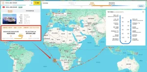
Our high-frequency AIS services provide position updates every 15 minutes near coastlines via terrestrial receivers, and every 1 to 2 hours in open ocean regions via satellite networks. The ETA engine recalculates destination arrivals dynamically if deviations occur.
For overland corridors (such as the Ibrahim Khalil border crossing), we combine GPS/cellular IoT sensors with route analytics. This enables logistics managers to monitor transit times and border crossing delays along regional highways.