Explore our leading container tracking, vessel AIS interfaces, and multi-modal logistics software solutions optimized for real-time visibility.
Founded in 2015, Trackingeyes stands at the forefront of global end-to-end logistics tracking and supply chain visualization solutions. Guided by an elite founding team possessing over ten years of deep maritime operations and software engineering experience, we dissect the core complexities of transoceanic freight and real-time tracking.
We specialized in unified, high-integrity cargo intelligence spanning sea, air, and rail. By bridging the gap between raw hardware transponder telemetry and operational business intelligence, we serve thousands of import and export enterprises, freight forwarders, and platform developers worldwide. Through customizable API integrations, we empower enterprises to transform reactive logistics management into predictive, automated workflows.
🚀 Unified Data Integration: Direct gateways linking ocean, air, rail, customs hubs, and carrier platforms.
🛰️ Real-time AIS Telemetry: Combining terrestrial stations and low-earth-orbit (LEO) satellite feeds.
📊 Machine-Learning ETAs: Eliminating routing errors with neural networks trained on historical shipping lanes.
⚡ Developer-First Architecture: Clean, high-throughput REST APIs designed to support multi-million call scaling.

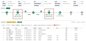
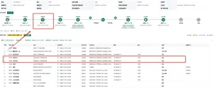
A comprehensive analysis of AIS tracking capabilities, global industrial application scenarios, and the technological framework powering today's visual supply chain.
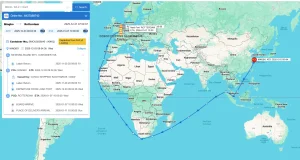
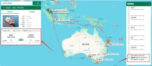
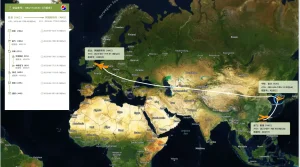
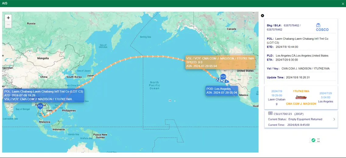
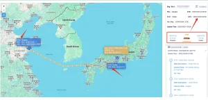
Automatic Identification System (AIS) technology has evolved past collision avoidance to become the cornerstone of digital maritime trade. By capturing dynamic data (latitude, longitude, speed over ground, heading) and static data (cargo class, draft, destination), our wholesale AIS systems facilitate full-fleet transparency, removing operational blindspots across oceanic transit.
Leveraging deep learning architectures trained on over a decade of maritime voyages, our proprietary algorithms analyze port congestion, weather patterns, historical routes, and real-time vessel telemetry. This translates raw tracking data into highly reliable, dynamic ETA predictions, giving warehouse managers and importers a competitive head start.
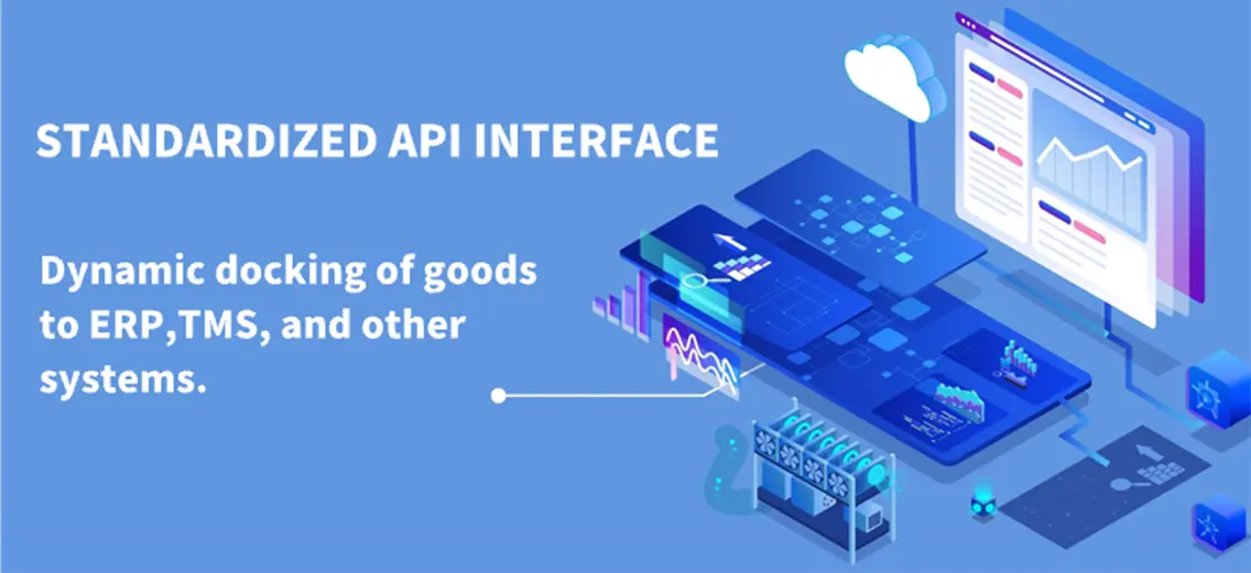
Modern visual ocean logistics rely heavily on system cohesion. The Trackingeyes API acts as an automated middleware layer, extracting live shipping schedules, container status updates, and customs milestones directly into corporate systems like SAP, Oracle, and proprietary supply chain platforms, avoiding manual lookup costs.
Industrial logistics systems frequently encounter disruption due to localized operational bottle-necks. The application of dynamic AIS tracking systems ranges far beyond identifying coordinates; it plays a critical role in strategic freight management:
Integrating AIS data sources through an API platform guarantees that the real-time dynamics of inbound commodities are automatically routed back to internal operational modules and client-facing interfaces. This enables logistics firms, cross-border e-commerce networks, and software aggregators to run proactive risk modeling and cargo delay mitigation programs.
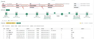
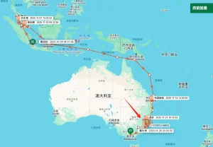
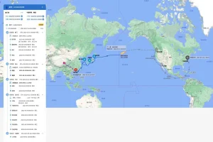
Our platform aggregates data feeds from deep-sea ports, customs hubs, and carrier partnerships globally. This unified approach eliminates data gaps, offering a visual window from production lines to the destination warehouse gates. Customers gain full operational visibility over every step in the distribution lifecycle.
How our industrial ecosystems, hardware-software integration, and location at the heart of the maritime trade network yield unrivaled wholesale value.
Operating out of the primary electronics and manufacturing cluster of southern China, our production plants utilize local supply chain integration to maintain superior turnaround times. This strategic localization brings key advantages:
1. Dynamic Part Sourcing: Immediate access to cutting-edge microchips, RF modules, low-power GPS microprocessors, and rugged maritime casing components directly reduces development cycles and manufacturing overhead.
2. Agility in Prototyping: We transition from engineering schematic adjustments to functional prototype hardware validation in days rather than weeks, allowing for rapid customization of antennas, power modules, and specialized firmware configurations.
3. Strict Industrial Quality Control: Our factories follow ISO 9001 and marine electronic standardizations (such as IEC 60945), subjecting all hardware components to rigorous thermal stress tests, saltwater spray testing, and vibration checks before distribution.
Our roadmap reflects our commitment to continuous technological development, ensuring that our clients are prepared for next-generation logistical challenges:
| Telemetry Type | Frequency Range | Update Intervals | Best Application Scenarios | System Dependency |
|---|---|---|---|---|
| Terrestrial AIS (T-AIS) | 161.975 MHz - 162.025 MHz | 2 - 10 Seconds (dynamic) | Near-shore routing, port area monitoring, coastal zone safety. | Line-of-sight shore stations (range ~40 nautical miles). |
| Satellite AIS (S-AIS) | VHF Maritime Band (LEO) | 15 - 90 Minutes (mesh dependent) | Open ocean tracking, transoceanic voyage analytics. | Satellite payloads, orbit constellational configurations. |
| Hybrid IoT Telematics | VHF / cellular (LTE-M, NB-IoT) | Near real-time (dual transmission) | Intermodal freight, multi-segment land-sea corridors. | Combined local transponders & cellular roaming gateways. |
| API Orchestrated Schedules | Cloud Data Interconnects | Dynamic scheduled calls | Port congestion prediction, automated cargo ETA management. | Direct server-to-server data aggregation layers. |
Key phases detailing our research and development journey as we advance tracking capabilities for global logistics.
Establishing high-gain VHF receiver designs and digital filters to isolate signals in highly dense maritime corridors and ports.
Bridging ground-level terrestrial networks with low-orbit satellite constellations for uninterrupted global coverage across major oceans.
Deploying predictive ETA modeling engines using historical weather, voyage data, and port queue analytics to replace static ETA estimates.
Connecting ocean vessel tracking, air cargo API gateways, and North American rail networks into a single, cohesive tracking platform.
Ensuring that our products and software interfaces remain aligned with complex international maritime, regional data privacy, and hardware certifications.
Our telematics hardware operates within international frequency allocations and complies with FCC, CE, and RoHS standards. We verify that all transponders meet maritime transmission safety guidelines (ITU-R M.1371) to ensure trouble-free installation on any commercial vessel class.
Our APIs and data collection systems feature end-to-end encryption (TLS 1.3) and conform to regional privacy structures like GDPR. Client inventory lists, route coordinates, and customs declarations remain secure and accessible only to authorized systems.
With server centers distributed across the Americas, Europe, and Asia, our systems offer high availability and low latency. This design keeps API response times minimal and helps prevent service interruptions, even during peak operational hours.
Expert insights addressing key technical inquiries regarding AIS installations, API data feeds, and global shipping workflows.
Terrestrial AIS (T-AIS) relies on shore-based stations to receive VHF signals, offering high frequency updates within range of the coast (~40 nautical miles). Satellite AIS (S-AIS) uses low-earth-orbit satellite constellations to capture signals globally, including the open ocean, though with slightly higher latency due to satellite orbit intervals. The Trackingeyes platform combines both data streams to provide continuous, high-frequency updates throughout the entire voyage.
Our ETA updates rely on predictive models that process dynamic vessel speed, draft, destination port backlog, historical voyage paths under similar conditions, and meteorological forecasts. This approach yields significantly higher accuracy than static carrier ETAs, helping shippers mitigate container detention risks and demurrage costs.
Yes. Our solutions feature open, developer-friendly REST and Webhook APIs that output clean JSON data. This allows for direct integration with key ERP systems like SAP, Oracle, and Microsoft Dynamics, as well as proprietary warehouse management systems, enabling automated workflows and reports.
Our manufacturing facilities operate under strict ISO 9001 quality management systems. All hardware undergoes thorough environmental testing, including thermal stress tests, vibration resistance checks, and salt-spray testing, to ensure long-term durability in harsh marine conditions.
By using custom geofencing, our platform tracks when a vessel enters specific national waters or approaches designated ports. The system automatically triggers milestones that can alert customs brokers to initiate declaration processes, helping to minimize delays at terminal release points.
Our platform tracks terminal gates, vessel discharges, and actual container groundings in real time. Automated notifications are sent to local drayage teams when the container is ready, preventing missed pickups, terminal dwell penalties, and extra storage fees.
Yes. Trackingeyes offers a multi-modal tracking approach. We support ocean freight monitoring, air freight tracking, and key rail node integrations (including North American rail networks) to provide a single, unified view across the entire supply chain.
All data transmissions are secured using enterprise-grade TLS 1.3 encryption. In addition, our systems are built in compliance with GDPR guidelines, ensuring that commercial shipment information, routing, and access logs are protected against unauthorized access.
Select from our range of automated data tracking solutions, schedule APIs, and integrated logistics engines to improve your supply chain visibility.