Founded in 2015, Trackingeyes is a premier global manufacturer and provider of end-to-end logistics tracking and supply chain visualization solutions. Headquartered at the epicenter of maritime supply chain infrastructure, our founding team brings over a decade of hands-on logistics expertise to resolve critical industry bottlenecks. We address structural blind spots by providing standardized, ultra-clean, and multi-source aggregated Marine AIS data to global import-export enterprises, shipping giants, and software providers.
The modern maritime industry requires more than raw coordinates; it demands contextual, enriched, and highly reliable temporal datasets. By combining satellite telemetry (S-AIS), terrestrial receiver matrices (T-AIS), and port authority networks, Trackingeyes translates fragmented maritime transmissions into actionable business intelligence. We enable global corporations to track assets in real time, mitigate detention and demurrage liabilities, and restructure their supply chains for maximum resilience.
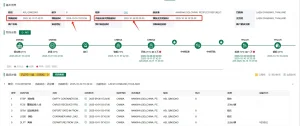
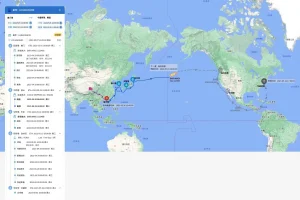
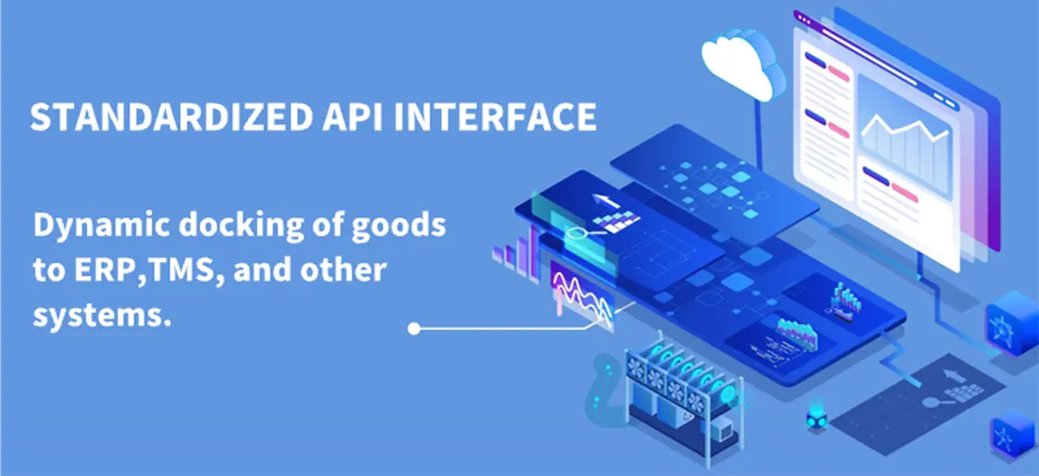
Comprehensive Integration: Automatically map dynamic cargo statuses into ERP systems via RESTful API Webhooks.
Predictive Science: Deep neural networks predict accurate ETAs by calculating weather bottlenecks, canal transit times, and port congestion indices.
Analyzing the strategic shift from raw signal transmission to semantic, high-fidelity spatial data engines.
Over 90% of global trade by volume is carried by sea. Managing this complex supply web relies on the Automatic Identification System (AIS)—a system originally designed for collision avoidance at sea, which has now evolved into the bedrock of global supply chain intelligence. In today's commercial landscape, multinational logistics enterprises and digital supply chain platforms are shifting from legacy batch processing to sub-minute real-time data streaming.
However, raw AIS transmissions are prone to signal dropouts, data corruption, and "dark vessel" anomalies. For high-volume manufacturing sectors, automotive supply chains, and bulk commodities trading, these inaccuracies directly cause costly shipping delays. Consequently, securing a direct stream of high-quality Marine AIS data from an authoritative data manufacturer is a prerequisite for achieving logistics resilience and maintaining competitive margins.
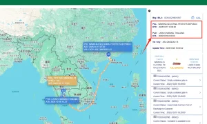
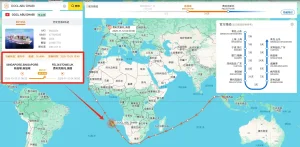
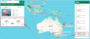
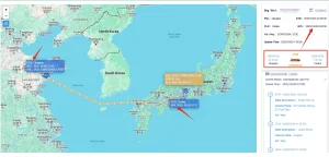
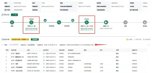
Real-time vessel positioning helps vessels navigate safely, preventing collisions in busy fairways and ports through continuous tracking of MMSI, vessel names, and dimensions.
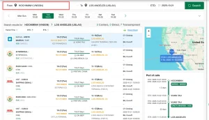
Integrating clean AIS data feeds directly into enterprise resource planning (ERP) suites allows logistics teams to track import container positions, manage warehouse scheduling, and cut down demurrage costs.
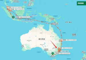
Enables harbor offices and terminal operators to accurately predict anchorage duration, automate berth planning, and improve crane efficiency using highly detailed data points.
How Trackingeyes transforms raw satellite and terrestrial radio frequency data into high-value structured insights.
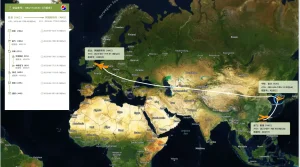
At Trackingeyes, the path from raw VHF radio frequencies to a structured, low-latency API response is handled by our advanced data pipeline. Raw AIS packets (conforming to ITU-R M.1371 protocols) are continuously ingested from thousands of proprietary and partnered terrestrial listening posts, along with constellation-based LEO satellite feeds.
Our proprietary data system resolves coordinate drift and message collisions in high-density waterways like the Malacca Strait, Shanghai Port, and the English Channel. Our multi-stage pipeline works as follows:

Tailoring marine AIS data to meet specific regional requirements, operational settings, and regulatory frameworks.
Our localized networks provide high-density coastal data coverage. By integrating regional terrestrial stations, we offer maritime authorities real-time, high-rate tracking of vessels within territorial limits, helping ensure safety and environmental compliance.
We deploy customizable virtual boundaries (geofences) around major ports. This enables automatic logging of vessel arrival and departure times (ATA & ATD), simplifying wharf logistics and reducing manual reporting workloads.
AIS signals behave differently on inland waterways compared to open seas. Trackingeyes tailors receiver networks to handle complex terrain along river routes, helping cargo barges safely transit busy lock systems and narrow channels.
Operating from the heart of the world's most active shipping routes, Trackingeyes leverages China's advanced manufacturing and technology ecosystem to deliver high-quality data services. This environment enables rapid development, testing, and scaling of both hardware and software solutions. Our proximity to major shipping hubs allows us to quickly validate our AI tracking models in real-world scenarios.
Our data infrastructure takes advantage of high-capacity Chinese server clusters, offering robust reliability and performance. This scale enables us to process vast amounts of telemetry data efficiently, allowing us to offer cost-effective, high-availability data solutions to global supply chain partners.
Additionally, our localized hardware supply chain guarantees a steady supply of AIS receivers, antennas, and processing units. This helps us expand our terrestrial listening network and ensures continuous service availability for our global customers.

Developing next-generation maritime tracking systems powered by AI, VDES, and carbon emission analytics.
Deploying VDES-compatible hardware to handle higher data bandwidths, improving transponder performance, and ensuring seamless integration with modern maritime communication networks.
Utilizing deep learning models to predict vessel routes and arrival times. The system analyzes historical routes, weather patterns, and port workloads to optimize supply chain scheduling and reduce carbon emissions.
Combining vessel performance models, hull data, and voyage tracking to estimate fuel burn and emissions. This assists maritime operators in monitoring compliance with international carbon reduction requirements.
Handling global maritime data requires adherence to strict privacy, security, and legal standards. Trackingeyes operates in compliance with international data regulations. Our systems are protected by robust encryption to ensure that sensitive customer data and commercial information remain secure.
We follow strict internal guidelines to protect data integrity and prevent unauthorized access. This reliability makes Trackingeyes a trusted data partner for logistics firms, financial organizations, and global manufacturers alike.
Answering common technical and operational questions about Trackingeyes' AIS data solutions.
Raw AIS data is prone to transmission errors, duplicate records, and spatial drift. Trackingeyes filters and refines this raw data, using machine learning to fill in gaps and resolve errors. This delivers a clean, accurate database of coordinates and times suitable for enterprise use.
Our APIs support both pull requests and push notifications. Terrestrial AIS feeds update in near real-time (sub-minute intervals), while satellite-derived coordinates update every 15 to 45 minutes, depending on satellite passes and regional coverage.
Yes. Our RESTful API webhooks deliver structured JSON payloads. These format-standard feeds can be integrated into custom enterprise platforms, logistics software, and ERP systems like SAP, Oracle, or Microsoft Dynamics.
When a vessel's transponder is turned off or blocked, our path-prediction algorithms estimate the ship's position based on historical routes, ocean currents, wind conditions, and reported speeds. This maintains reliable ETA estimates even during temporary signal outages.
Yes. We offer historical databases dating back to 2015. Customers can request specific geographical regions, vessel classes, or timeframes to support academic research, market analysis, and trade flow studies.