Explore our top-performing maritime positioning engines, industrial integration layers, and real-time tracking terminals optimized for complex global supply chains.
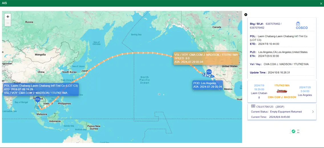
The Automatic Identification System (AIS) serves as the digital foundation of modern maritime transport. By broadcasting static, dynamic, and voyage-related data, vessels communicate key parameters to both terrestrial base stations and Low Earth Orbit (LEO) satellite constellations. At the heart of parsing this data is the AIS Ship Type classification, an international numerical code index designated by the International Telecommunication Union (ITU) and the International Maritime Organization (IMO).
Understanding these classifications is vital for terminal operations, port agencies, and enterprise logistics systems. For instance, an AIS Ship Type code falling in the 70s designates Cargo vessels (e.g., Code 70: Cargo, 71: Cargo - Hazard Cat A), whereas codes in the 80s denote Tankers (e.g., Code 80: Tanker, 84: Tanker - Hazard Cat D). Trackingeyes leverages this structural classification metadata to optimize container allocation schedules, predict berth congestion, and generate real-time sailing schedules, eliminating blind spots in complex multi-modal ocean logistics networks.
| AIS Ship Type Code Range | Vessel Class / Segment | Operational Characteristics | Data Updates Frequencies |
|---|---|---|---|
| 30 - 39 | Fishing Vessels, Tugs & Special Crafts | Highly variable patterns, coastal operation priority | Dynamic (3 min - 10 sec) |
| 60 - 69 | Passenger Ships & Cruise Liners | Strict scheduling, high priority routing | Dynamic (2 sec - 10 sec) |
| 70 - 79 | Cargo Vessels (Bulk, Container, Ro-Ro) | Global routes, heavily dependent on draft parameters | Dynamic (2 sec - 10 sec) |
| 80 - 89 | Tanker Fleets (LPG, LNG, Oil Tankers) | Stringent hazard classifications, high compliance load | Dynamic (2 sec - 10 sec) |
| 90 - 99 | Other Special Categories (Dredgers, Military) | Customized work patterns, erratic path vectors | Dynamic (Variable) |
Standard data platforms often yield basic latitude/longitude information without context. Trackingeyes introduces Information Gain to maritime operations by combining raw AIS Class A and Class B streams with semantic data enrichment. Through neural-network-driven predictive engines, we parse the "vessel type" metadata, historical track logs, port density indexes, and weather matrix patterns. This enables our enterprise software partners to bypass typical limitations (such as transponder blackout periods or satellite blind spots) and secure clean, actionable data APIs.
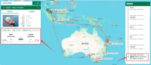
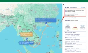
Establish dynamic geofences around critical canals, straits, and ports. Get instantaneous alerts when specific AIS ship types enter predefined logistics zones.
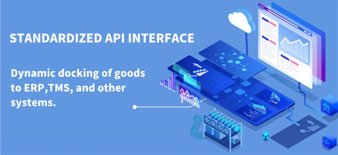
Seamlessly integrate tracking matrices into SAP, Oracle, and proprietary supply chain suites via robust RESTful APIs to control operational risks.
Machine learning models predict actual arrival times using historically optimized vessel speeds, route patterns, and congestion markers for AIS Ship Types.
The global shipping framework depends highly on hardware reliability. China's manufacturing ecosystem for marine telecommunications provides an unparalleled supply chain advantage. The concentration of advanced electronics plants in manufacturing hubs like Shenzhen, Ningbo, and Shanghai enables the production of top-grade Class A and Class B AIS transponders, satellite receivers, and IoT logging devices. This hardware ecosystem supplies the raw telemetry data that power advanced global networks like Trackingeyes.
Integrating factory-level hardware reliability with Trackingeyes' deep software analytics gives global enterprises unique procurement advantages:
Procuring global tracking data requires rigorous compliance with service level agreements (SLAs). Large industrial enterprises, freight forwarders, and logistics operators need resilient data integrations that protect business continuity. Key enterprise requirements include:
APIs must deliver tracking coordinates within milliseconds of ingestion to ensure real-time dashboards reflect actual positions during port entry/exit.
Data transmission must leverage secure protocols (HTTPS, TLS 1.3) with localized data residency options to adhere to cybersecurity standards.
Instantaneous system-to-system notifications on ETA changes, port-opening alerts, and potential demurrage events.
Operating a global tracking network requires compliance with diverse national and international regulatory frameworks. Trackingeyes protects its data pipelines through localized compliance architectures. For example, our data ingestion routes comply with European General Data Protection Regulation (GDPR) requirements concerning crew and staff identifiers, and we strictly follow the Data Security Law of the People's Republic of China regarding boundary information controls.
Furthermore, our tracking algorithms align with the International Maritime Organization (IMO) SOLAS regulations, ensuring that all AIS Ship Type mapping matches official classification databases. This rigorous compliance allows shipping firms, port operators, and trading agencies to integrate our APIs without compliance friction.
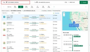
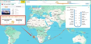
During peak seasons, major ports like Shanghai or Rotterdam experience significant delays. Using our high-quality data feeds, logistics companies track container vessels (AIS Ship Type Code 70-79) and automatically trigger port-opening alerts to optimize pick-up and drayage scheduling.
Intermodal transitions in North American rail corridors require precise sea-to-land handoffs. Trackingeyes bridges the tracking gap by correlating vessel arrivals with rail terminal capacity plans, minimizing container dwell time at West Coast ports.
Time-sensitive cold chain logistics rely on accurate ETA tracking. Real-time dynamic updates allow cold chain managers to redirect inland container transport fleets dynamically if a vessel faces offshore delays.
The maritime industry is digitizing rapidly. Key trends over the next five years include:
Founded in 2015, Trackingeyes is a leading provider of global end-to-end logistics tracking and supply chain visualization solutions. With a founding team boasting over ten years of logistics expertise, we deeply understand industry pain points. We specialize in global end-to-end cargo tracking by sea and air, serving thousands of import and export enterprises worldwide. Our services include customizable tracking solutions and open API data interfaces to enhance supply chain visibility and operational efficiency.
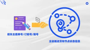
Through the Trackingeyes’ Platform, customers can quickly connect with hundreds of global data sources, greatly improving the efficiency and intelligence of logistics tracking. The platform achieves full chain data coverage from the source to the terminal through the collection and aggregation of data sources, including logistics information from various data sources such as stations, terminals, customs, shipping companies, and airlines.
Through API interface integration, the dynamics of goods can be automatically written back to internal systems and customer service systems of the enterprise, assisting global logistics enterprises, supply chain enterprises, cross-border e-commerce enterprises, software platforms and other enterprises to achieve more efficient and refined goods tracking management, and to do risk control and prediction in advance.
Unlock end-to-end visibility with our trusted tracking platform. We bring proven reliability to both ocean and air cargo tracking, giving you the accurate data and control needed to streamline operations from port to runway.


Streamline your maritime logistics with high-fidelity tracking data tailored to your ERP and operations.
Contact UsFind answers to technical and operational questions regarding AIS ship classifications, data feeds, and integrations.
We process static telemetry packets (ITU-R M.1371) containing "Ship Type" identifiers (codes 30-99). These signals are parsed, cross-referenced with global registries, and mapped to cargo, tanker, passenger, or auxiliary vessel categories.
Yes. When AIS signals are blocked or interrupted in high-congestion regions or remote open oceans, our machine-learning model predicts the vessel’s trajectory based on historic tracks, speed patterns, and current conditions.
We provide RESTful APIs and Webhook solutions. Data can be directly integrated into standard platforms (like SAP, Oracle, and Microsoft Dynamics) or proprietary management portals using our developer-friendly documentation.
Our systems comply with the GDPR, the Chinese Data Security Law, and IMO guidelines. We filter sensitive tracking details while maintaining the operational data integrity required for commercial freight management.
Yes, our API and software suite let you define customized geofences for key ports and canals. You can choose to trigger automatic alerts based on factors like ETA updates or vessel arrivals.
Discover our comprehensive collection of real-time AIS tracking, sailing schedule matching, and logistics prediction software packages.